nev
Super Térrarist
Since I'm not working at the moment, any day is a good day for a ride, so after checking that weather forecasts were looking acceptable a route was plugged into the GPS and the alarm was set for 5:30am Wednesday.
5:46 I was geared up and on my way. Out of Melbourne north bound and first stop was Echuca for fuel.
The pub at Gunbower

Crossed the NSW border at Barham and had a quick break at Tullakool, which started as a WWII POW camp for Italian prisoners before becoming commercial rice farms after the war. In total about 12000 Italian POWs were brought to Australia during the war to work on farms to replace the men who had gone to fight.

A bit further up the Moulamein road was a viewing platform for the irrigation system

Though, there's not much irrigation going on here in these dry channels.

A quick break by the river in Moulamein

About 10km of the road from Moulamein to the Sturt Hwy is still dirt but a good rate of knots is still practical, and once I crossed into the Hay shire, the road improved considerably

This should link to a 3D view of the above (if you're using a compliant browser like firefox or chrome)
https://plus.google.com/104648580394866335637/posts/MRGX725Rt8g
Once I hit the Sturt Hwy headed into Hay for fuel then further east to Darlington Point. Although I've ridden through Hay a few times I've never ridden this section of the Sturt Hwy east of Hay. Stopped in Darlington Point and bought some lunch. When I was a kid I had some cousins who lived here and we visited whenever we were travelling north, so I always stop in town if I'm passing through.

And a Bill's trough behind the pub

One of 4 irrigation channel diggers imported to dig irrigation channels in the Riverina.

The countryside in this area is quite unique. I never see this type of gum anywhere else in Australia.

Detoured a little off the main street in Jerilderie. This building was the Telegraph/Post Office


and a nice lake in town

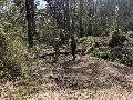
The RFS must be burning off near Tocumwal

The old bank building in Tocumwal

And a Bill's trough at the pony club

Hope vines near Numurkah

Last fuel stop was in Kialla, and I rolled into the garage at home at 5:26pm.
GPS track of the trip.
https://www.google.com/maps/d/edit?mid=zsD-yxSKFWwk.kWQftrvDjG0I&usp=sharing
And just to give people who haven't travelled these areas of Australia before some idea of how flat most of this country is, Excluding the first 150km or so and the last 120km (crossing the great dividing range) the middle 750km of this ride (Rochester to Mangalore) has a total elevation ascent and descent of 210metres and 205 metres respectively. That's an average gradient of 1:1900. (about 50cm per km).
5:46 I was geared up and on my way. Out of Melbourne north bound and first stop was Echuca for fuel.
The pub at Gunbower
Crossed the NSW border at Barham and had a quick break at Tullakool, which started as a WWII POW camp for Italian prisoners before becoming commercial rice farms after the war. In total about 12000 Italian POWs were brought to Australia during the war to work on farms to replace the men who had gone to fight.
A bit further up the Moulamein road was a viewing platform for the irrigation system
Though, there's not much irrigation going on here in these dry channels.
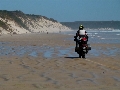
A quick break by the river in Moulamein
About 10km of the road from Moulamein to the Sturt Hwy is still dirt but a good rate of knots is still practical, and once I crossed into the Hay shire, the road improved considerably
This should link to a 3D view of the above (if you're using a compliant browser like firefox or chrome)
https://plus.google.com/104648580394866335637/posts/MRGX725Rt8g
Once I hit the Sturt Hwy headed into Hay for fuel then further east to Darlington Point. Although I've ridden through Hay a few times I've never ridden this section of the Sturt Hwy east of Hay. Stopped in Darlington Point and bought some lunch. When I was a kid I had some cousins who lived here and we visited whenever we were travelling north, so I always stop in town if I'm passing through.
And a Bill's trough behind the pub
One of 4 irrigation channel diggers imported to dig irrigation channels in the Riverina.
The countryside in this area is quite unique. I never see this type of gum anywhere else in Australia.
Detoured a little off the main street in Jerilderie. This building was the Telegraph/Post Office
and a nice lake in town
The RFS must be burning off near Tocumwal
The old bank building in Tocumwal
And a Bill's trough at the pony club
Hope vines near Numurkah
Last fuel stop was in Kialla, and I rolled into the garage at home at 5:26pm.
GPS track of the trip.
https://www.google.com/maps/d/edit?mid=zsD-yxSKFWwk.kWQftrvDjG0I&usp=sharing
And just to give people who haven't travelled these areas of Australia before some idea of how flat most of this country is, Excluding the first 150km or so and the last 120km (crossing the great dividing range) the middle 750km of this ride (Rochester to Mangalore) has a total elevation ascent and descent of 210metres and 205 metres respectively. That's an average gradient of 1:1900. (about 50cm per km).
 Nice work as always Nev