Redundancy Ride 2009 - Round Oz by Scrambler

glitch

Mapping the next ride...
Staff member
Picture-102-L.jpg

]


Good one, innit.
They still had the boomgates up there?
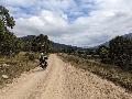
Great vistas to the coast and the mouth of the Tweed Valley from up top.
 

Sir Francis

Displaced person
And it also was "Scaredofthedirt" in those days, I guess :)

After the Enfield Bullet ride through the Himalyas and Kashmir, it was more like "notso-Scaredofthedirt" but it was still mainly bitumen. It sure would be a different ride today on the Tiger...

They still had the boomgates up there?
.

Yep. The camera mounted on the border freaked me out (yes, I was traveling with gusto) until I was told it was to monitor horse/livestock transport not speeding Scramblers...:)
 

glitch

Mapping the next ride...
Staff member
Yep. The camera mounted on the border freaked me out (yes, I was traveling with gusto) until I was told it was to monitor horse/livestock transport not speeding Scramblers...:)


The more I look at it, the more I like that shot.
Somehow, that Mt. Warning seems to have a dominant shape regardless of from what direction one looks at it....coming from Kyogle, Nimbin or the coast. Like Mt. Roland in Tassie...
 

BB63

SV, DRZ & now DL Rider
Day 9: Maryvale to Maryvale


An early start after a quiet night at the historic Maryvale Hotel.


I know that place, I spent a night at the Maryvale pub a couple o years back when Warwick got flooded and i couldnt get thru, even the bridge imto Maryvale went under a couple of minutes after I got into town. Luckily I got the last room in the pub, A great feed and an even better night to be had with the locals. :clap:
Cheers Brian
 

Sir Francis

Displaced person
Day 10: Maryvale to Tiaro

Distance: 440 km Total: 4,217 km

Back to Towoomba to buy a replacement camera – my Olympus “tough camera” had broken the night before when it fell from a coffee table. Grrrr….

Sadly, not much in the way of photos today.

I rode around the Somerset Dam and took the back roads into the Glasshouse Mountains.


I rode the ridgeline to Maleny, then Kenilworth and Imbil before hitting the Bruce Hwy at Gympie.

My head still hurts from the hang-over from the last time I stayed in Gympie (in 2001) so I continued north.

On dusk, I crashed at the 1887 Tiaro Hotel for the night.


I met a young couple who seemed to have the perfect school holiday job – they were paid by the local tourist board to stay at all of the camping spots and ask fellow campers what they thought about each spot.
 

Sir Francis

Displaced person
Day 11: Tiaro to Calliope River

Distance: 468 km Total: 4,685 km

I lazed in the sunshine waiting for the day to warm.

I spent some time cruising around Maryborough taking in the elegant old buildings before hitting the coast at Hervey Bay.

It’s easy to see why Hervey Bay is rated as one of the happiest places to live in Oz.


I skipped the Bundaberg Rum distillery this trip and made for 1770.


I had wanted to overnight at the beachside camp ground and drink the afternoon away at the funky driftwood bar/café.


Unfortunately, the bar had closed and the campground was jam-packed.


Time to make camp at Calliope River free camp.


Sir Francis

Displaced person
Day 12: Calliope River to Finch Hatton Gorge

Distance: 557 km Total: 5,242 km


A procession of grey-nomads slowed my packing. They commended me as a young fella to be riding a real motorcycle like they made them back in the day and congratulated me for the mint restoration job I had done. When told the bike was six months old, they’d fetch their wife…”honey, look they’re making Triumphs again…it looks like the one I used to have…perhaps, we could get one…” An offer of coffee and breakfast usually followed. I was heartened by their interest and generosity.


I stopped for a photo at


There was not much to see on the highway to Mackay.


I took a left turn and rode through the cane fields.


Sugar cane was being harvested. You could taste it in the air.


I climbed the range to Eungella.


And got to watch a platypus frolic in the wild.


Back down the hill to look for somewhere to overnight.

I stumbled across this place owned by a kookee Vietnam war vet.


The tree huts were full but I secured a tent spot in the rain forest next to a fellow Triumph rider.


A night on the goon-bag with my new Tiger buddy and the voofer girls from the tree huts.
 

glitch

Mapping the next ride...
Staff member
[/SIZE][/FONT]

Picture-163-L.jpg


[/SIZE][/FONT] Back down the hill to look for somewhere to overnight.

I stumbled across this place owned by a kookee Vietnam war vet.


Sounds like a great spot!

Absolutely beautifull area, Mackay's backdrop.

Went through Owens Creek on the way to Mt. Ossa and back to the Hwy when we rode the posties to Cairns...the whole area is full of bumpy single-laners, lots of dirt roads and all those narrow gauge cane-trains :slobb

Enjoying this a lot...thanks for posting it up!!
 

Sir Francis

Displaced person
Day 13: Finch Hatton Gorge to Magnetic Island

Distance: 433 km Total: 5,675 km

Up before dawn for the 6km hike to the Ring of Fire.


The showers were open to the rainforest. Sadly, I’d missed the voofer girls…


More bumpy back roads through the cane fields to Townsville.

Perfect timing, I arrived just as the last vehicles were being loaded onto the ferry.


The campsite was booked out.

I got way too drunk with my backpacker roomies and woke up hugging a palm tree.
 
Top Bottom