
penguineer
just luscious
Day 0 - in which I attempt to pre-emptively excuse myself
OK - the onslaught begins.
About two years ago at the AKRON forum get together at Jindabyne, Tas invited us to come along to the DogHouse Social Club poker run at Burnie, Tasmania.
By coincidence the 2013 Australian Adventure Travel Film Festival(held in Bright, Victoria) fell on the weekend prior to the poker run - so it made sense to combine the two trips. The return trip depended on how I felt at the time, but I did want to do the Great Ocean Road while I was close
The planned route was something like:
- head south and ride Oxley highway(great road),
- head south then inland to avoid Sydney before tracking back to the coast
- depending on the bushfire situation either follow the coast into Victoria and approach Bright from the south
- OR head back across the Snowy Mountains and approach Bright from the north
- after the movies, head direct to Melbourne and the ferry to Tasmania
- do a lap of Tassie in an anti-clockwise direction, making it up as I go along
- poker run in Burnie
- a day or two to just look around Northern Tasmania before the ferry back to the mainland
- Great Ocean Road
- head north to north-east depending on fires/floods/weather towards home
I had tried a more detailed trip plan, but this was complicated by bushfires in Victoria creating uncertainty over which roads would be open. Tasmania just had too much to rationally cover, so I decided to take a "make it up as I go along" approach - the only fixed points after my first day being the ferry over and back and the poker run itself.
I usually have a copy of the Australian Motorcycle Atlas(Bears' 100 great rides) in my tank bag for general navigation, and if there are any of the "good" roads near me I can make a bit of a detour.
I had a couple of other small goals or guiding ideas on this trip:
- camping enough to make carrying the tent worthwhile
- riding as many of the best motorcycle roads as practical
- try not to go back over the same road if avoidable
- beaches
- wombats
- penguins
- tasmanian devils
- visit MONA(Museum of Old and New Art) in Hobart
- try to sneak in an artesian spa somewhere along the way
...and the usuals of photographing "Big Things", "I've Been Everywhere Man" towns and weird road signs or anything unusual.
For those that aren't familiar with it, "I've Been Everywhere Man" is a song written by Ted Mack, that lists over 90 Australian towns in the lyrics. Lyrics were also written and performed for other countries, but I've never heard those versions.
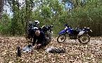
I've tried to take interesting photos to go with the narrative, but in a lot of cases you will be missing pictures of the roads - lets face it, I'm generally having fun and the best roads have few places to stop and take piccies. Besides, it's all(mainly) bitumen. My photos mostly only get resized for the web, although some re-alignment of the horizon may be done on particularly bad ones, so you may see power lines, rubbish bins and such - I'm pretty bad at taking and manipulating photos so what you see is what you get.
On this trip I'll be a tourist for a lot of the time, so won't be booking any great daily distances(I think my longest was only about 700km on the first day) as I spent my time looking around the place.
As usual, I had my SPOT2 running, keeping people at home guessing where I was going next - the complete map is here: https://spotwalla.com/tripViewer.php?id=5e7b51026f300a776
Also, on this trip I was running a beta version of an Android phone app called Bubbler GPS written by Joel Tolbert - as I write Joel has just announced that he's putting the release version on Google Play. He's done some sterling work on the software and it promises to make documenting trips much easier. The full release version also allows you to send photos with your OK updates – it’s a good thing the beta didn’t have it as I would have tortured Joel by sending photos of sunny beaches as he sat under three feet of snow in Chicago!
And, as usual, I'll likely be shopping this write-up around a couple of places, so if there's people or groups you don't know or references to them, don't worry! If it bothers you, just ask - I'll try to keep an eye on replies....
It might take me a few days to crank out each update(I spend a lot of time on words) and I have about three weeks worth of a trip to do, so please be patient.
Cheers!
OK - the onslaught begins.
About two years ago at the AKRON forum get together at Jindabyne, Tas invited us to come along to the DogHouse Social Club poker run at Burnie, Tasmania.
By coincidence the 2013 Australian Adventure Travel Film Festival(held in Bright, Victoria) fell on the weekend prior to the poker run - so it made sense to combine the two trips. The return trip depended on how I felt at the time, but I did want to do the Great Ocean Road while I was close
The planned route was something like:
- head south and ride Oxley highway(great road),
- head south then inland to avoid Sydney before tracking back to the coast
- depending on the bushfire situation either follow the coast into Victoria and approach Bright from the south
- OR head back across the Snowy Mountains and approach Bright from the north
- after the movies, head direct to Melbourne and the ferry to Tasmania
- do a lap of Tassie in an anti-clockwise direction, making it up as I go along
- poker run in Burnie
- a day or two to just look around Northern Tasmania before the ferry back to the mainland
- Great Ocean Road
- head north to north-east depending on fires/floods/weather towards home
I had tried a more detailed trip plan, but this was complicated by bushfires in Victoria creating uncertainty over which roads would be open. Tasmania just had too much to rationally cover, so I decided to take a "make it up as I go along" approach - the only fixed points after my first day being the ferry over and back and the poker run itself.
I usually have a copy of the Australian Motorcycle Atlas(Bears' 100 great rides) in my tank bag for general navigation, and if there are any of the "good" roads near me I can make a bit of a detour.
I had a couple of other small goals or guiding ideas on this trip:
- camping enough to make carrying the tent worthwhile
- riding as many of the best motorcycle roads as practical
- try not to go back over the same road if avoidable
- beaches
- wombats
- penguins
- tasmanian devils
- visit MONA(Museum of Old and New Art) in Hobart
- try to sneak in an artesian spa somewhere along the way
...and the usuals of photographing "Big Things", "I've Been Everywhere Man" towns and weird road signs or anything unusual.
For those that aren't familiar with it, "I've Been Everywhere Man" is a song written by Ted Mack, that lists over 90 Australian towns in the lyrics. Lyrics were also written and performed for other countries, but I've never heard those versions.
I've tried to take interesting photos to go with the narrative, but in a lot of cases you will be missing pictures of the roads - lets face it, I'm generally having fun and the best roads have few places to stop and take piccies. Besides, it's all(mainly) bitumen. My photos mostly only get resized for the web, although some re-alignment of the horizon may be done on particularly bad ones, so you may see power lines, rubbish bins and such - I'm pretty bad at taking and manipulating photos so what you see is what you get.
On this trip I'll be a tourist for a lot of the time, so won't be booking any great daily distances(I think my longest was only about 700km on the first day) as I spent my time looking around the place.
As usual, I had my SPOT2 running, keeping people at home guessing where I was going next - the complete map is here: https://spotwalla.com/tripViewer.php?id=5e7b51026f300a776
Also, on this trip I was running a beta version of an Android phone app called Bubbler GPS written by Joel Tolbert - as I write Joel has just announced that he's putting the release version on Google Play. He's done some sterling work on the software and it promises to make documenting trips much easier. The full release version also allows you to send photos with your OK updates – it’s a good thing the beta didn’t have it as I would have tortured Joel by sending photos of sunny beaches as he sat under three feet of snow in Chicago!
The BubblerGPS map is here: https://spotwalla.com/tripViewer.php?id=5f485114472de8a28"Bubbler GPS is a secure personal location manager for phones and tablets, which allows you to store and share your travel memories via SpotWalla.com (http://SpotWalla.com/). Whether you are riding the highways, exploring the back country, or are dipping your line in search of the big one, Bubbler GPS has you covered."
And, as usual, I'll likely be shopping this write-up around a couple of places, so if there's people or groups you don't know or references to them, don't worry! If it bothers you, just ask - I'll try to keep an eye on replies....
It might take me a few days to crank out each update(I spend a lot of time on words) and I have about three weeks worth of a trip to do, so please be patient.
Cheers!


 ...love the shots of the old cafe at Long Flat.