junkmanjoe adventures

J

Junkmanjoe

Guest
Haloo to you all.
in here ill be posting up stories about my trips trails arond NZ. tar seal , gravel and of course mud...:thumbs:
 
P

Punisher

Guest
cant wait mate, i assume that dakar logo isnt just for show?
 
J

Junkmanjoe

Guest
ok one just to get the tast buds working...

this is a power pylon service track, which runs over the Tararua range, known as the Rimutaka hill.
this was a entry ride for new riders to the sport,
IMG_0052.JPG

we had a much better turn out than i hoped.
a little greasy and all up hill,
IMG_0056.JPG

we had heavy fog, so was quite neat.
once on top, pea soup..
IMG_0057.JPG

the track runs along a ridge and ends at the last pylon.
IMG_0064.JPG

weather was against us this ride, and proved very slippy on our way down.
on a good day views over lake wairarapa are great.

the road in the distance on the other hill is the main road.
IMG_6595.JPG

is a great local ride, and on a good day even better.
this last pic shows the main road on the right and the plyon track on the left.
Rimutaka%20HIll.jpg

cheers

JMJ
 
Last edited:
J

Junkmanjoe

Guest
cant wait mate, i assume that dakar logo isnt just for show?

i have the dakar painted on my safari tank.
and am in the market to buy a KTM 950, some time soon. well thats the plan any way..

JMJ
 

glitch

Mapping the next ride...
Staff member
the road in the distance on the other hill is the main road.
IMG_6600.JPG

is a great local ride, and on a good day even better.
this last pic shows the main road on the right and the plyon track on the left.
Rimutaka%20HIll.jpg

cheers

JMJ

:glu:glu Noice!!
Main Rd.= that's the weekend GP track?
Nice scratcher road on a weekday morning :glu

Man...keep it coming, this is gooood.
 
J

Junkmanjoe

Guest
it s a great road, but it had clamed a few riders, and cars, even a truck and trailer on day...
it gets windy as hell, has come close to claming my self on a few rides.
and it get closed to snow and ice at times..

not sure what happened to the photos..i fixed up one..
 
J

Junkmanjoe

Guest
The old Whangamomona road.

Eddie and i had just done the central north island ride.
I wanted to travel the old forgotten hiway back home on our last day, weather was damp and light showers, over the day.
Half way through this road, there is the old whanga road.
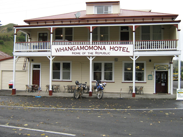
Eddie and i stoped at the Whangamomona pub for lunch.
IMG_0145.JPG

we asked the locals about the old road,
Oh no you guys dont want to go through there, eddie and i looked at each other,,,nooding yes we do...
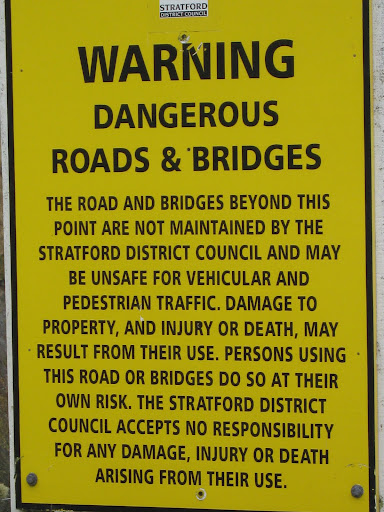
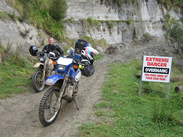
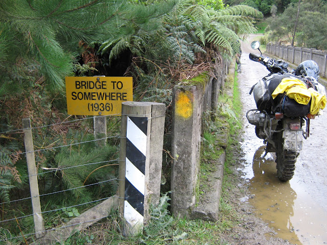
so off we went, we traveled along a good gravel road, which slowly turned to mud,and we came across this sign.
IMG_0146.JPG
i looked at eddie, shall we....yes repiled eddie...Hmmm was this a good idea or not...
IMG_0147.JPG

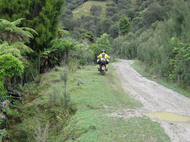
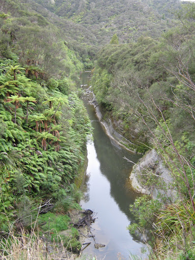
road was ok a little slippy in places but we just rode on the grass when we could,,thats not so bad. Great views of the whanga river.
IMG_0148.JPG

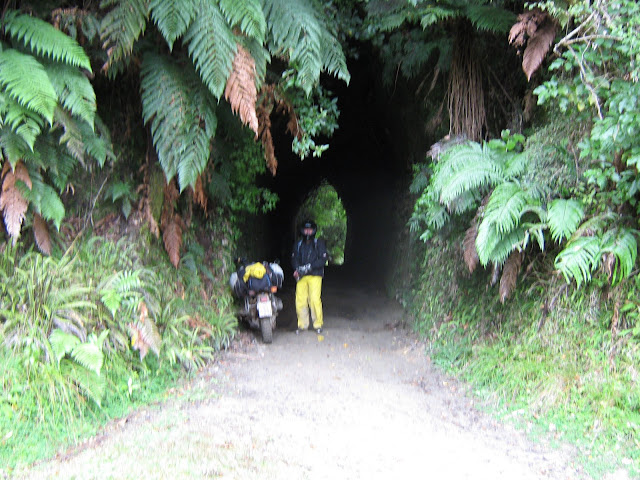
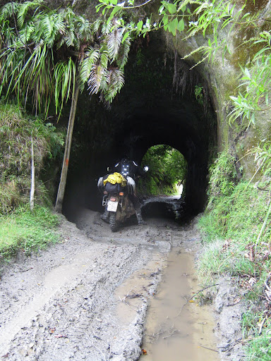
came around the bend and we find a old tunnel.on the other side is a punga log road,as road is so muddy now.
IMG_0149.JPG

so passed that section.
IMG_0152.JPG

road starts to turn to shit, big bog holes, fall off count so far, me at 2 times, think eddie at 3 spills.
a little futher down the road we came across another tunnel.
IMG_0155.JPG

what a neat road.
slipy slidy trying to stay up.
deep bog holes, i helped eddie out of one bog, and i got so covered in mud, just had to laugh...
IMG_0158.JPG

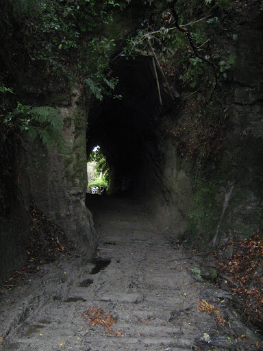
we walked through here first, and rocks were falling down the cliff on to the road.
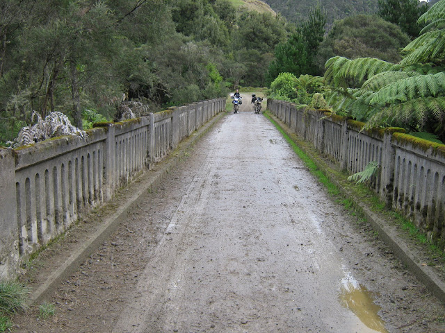
so we guned it through..finily 20kms and 3 hours later, we made it to the other end. out to the bridge to somewhere...
IMG_0160.JPG

we were so glad to see gravel again.
IMG_0162.JPG

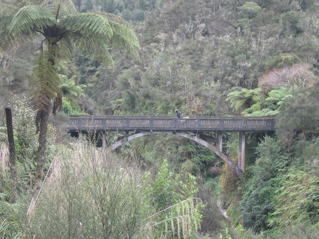
in this next photo see if you can see the log stuck under the bridge, and yes thats how high the river get in flood...
IMG_0164.JPG

thats our most enjoyable trip on the old whangamomona road.
a link to the road here.
http://maps.google.co.nz/maps?f=d&source=s_d&saddr=-39.157552,174.740167&daddr=Whangamomona+Rd&hl=en&geocode=%3BFZayqv0dlkBqCg&mra=dme&mrcr=0&mrsp=0&sz=15&sll=-39.165938,174.744716&sspn=0.024223,0.038409&ie=UTF8&ll=-39.1491,174.74242&spn=0.012114,0.019205&t=h&z=16
can follow the road along the side of the river.

JMJ
 
Last edited:
Top Bottom