
J
Jantar
Guest
The Southern Rider group each year organise a ride with a difference. They set a route of between 800 and 1200 km around the diffrent parts of the South Island incorporating touristy areas and roads less travelled. All roads are sealed to cater for the cruisers and weekend riders, but take you to places that you may normally just ride past. The route sheet includes a list of questions about the places you go past, and most of these require you to actually get off your bike and stretch the legs. The ride can be done at any time from the beginning of September to the end of November, and can be done in a single day, or spread over a number of days, or even as sections at different times. This year's route goes within 3 km of my gate so of course I had no excuse not to enter it, the only question was "When?"
Well today proved to be a beautifull day after a light snowfall last night, and I had an optician's appointment in Queenstown , 85 km away, at mid-day, so I looked at the southern part of the route. 643 km would make a nice afternoon ride and all going well I should arrive home in time for dinner if I'm on the road by 11:00 am.
First stop was Clyde for fuel and check the tyre pressures and a view of the Clyde Power Station: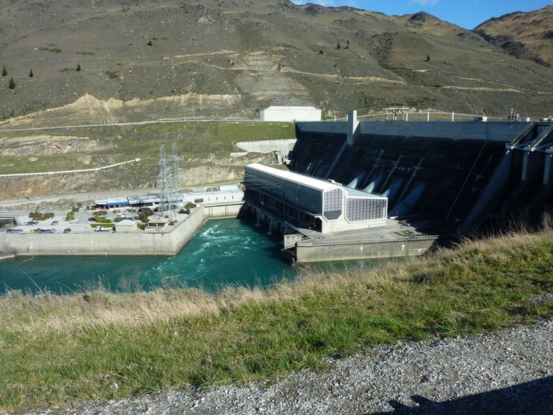
I'm pretty familiar with this place as that long window just to the right of the pylons is my office. The dam flooded one of New Zealands' most spectacular and inaccessable wild rivers and replaced it with Lake Dunstan that supports fishing, boating, swimming and rowing.
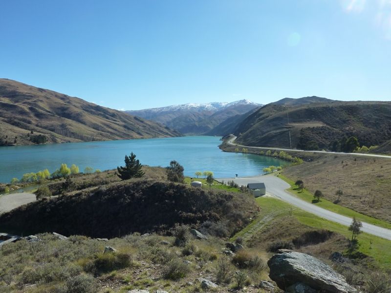
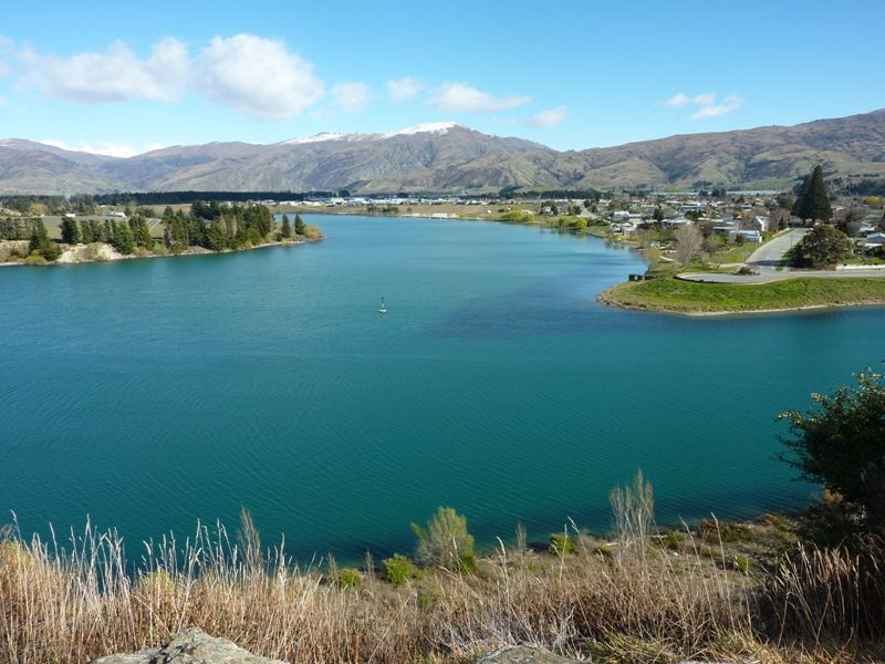
Looking up Lake Dunstan with the Dunstan Range behind:
25 km north is the meeting of the waters. The silty Kawerau River flows in from the west to meet the clear water of the Clutha River. When the lake was raised it flooded part of an historic town at Cromwell, but part of it is still standing as a memorial:
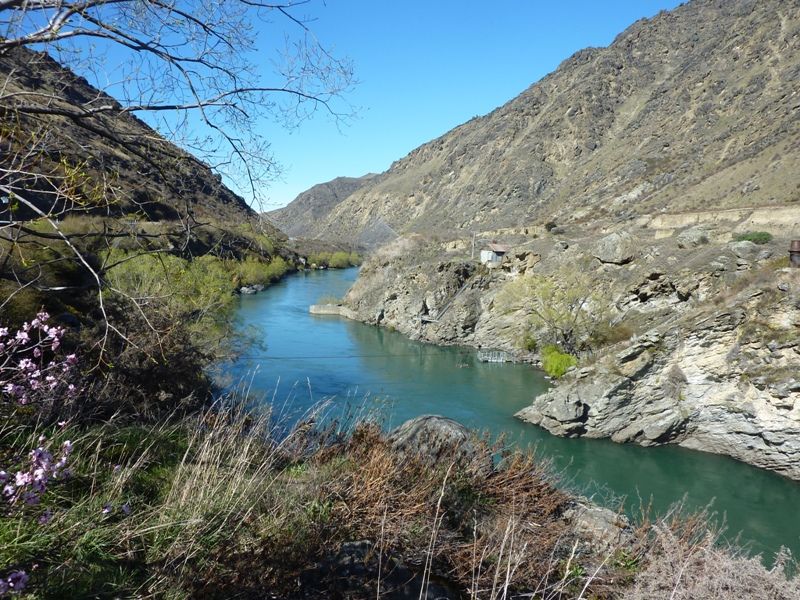
Into the Kawerau Gorge and I stopped for the first Escapade Question at the Goldfieds Mining Center. There is still plenty of gold in them thar hills, just not enough to be economical to recover. Instead tourists are shown how the old gold miners lived and get to experience panning for gold themselves. Looking back along the gold mining reserve a working water sluice can be seen spraying a jet across the river:
Closer to Queenstown is the wine growing area of Gibston Valley. The wines here are very good indeed, but priced accordingly. For the price of one bottle of wine from this region I can get happy with 6 bottles of Australian wine. (One of which I'm happily drinking while I type this):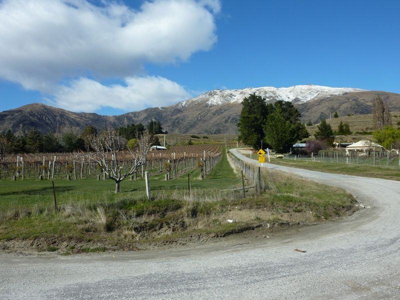
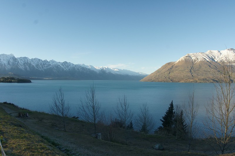
Most visitors to Queenstown only see the tourist shops in the town center. Locals prefer to shop at their own shopping center with New Zealand prices rather than Tokyo prices, and that is where I saw the optician. The remarkables are looking really good with a fresh touch of snow: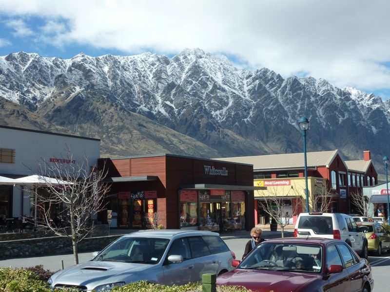
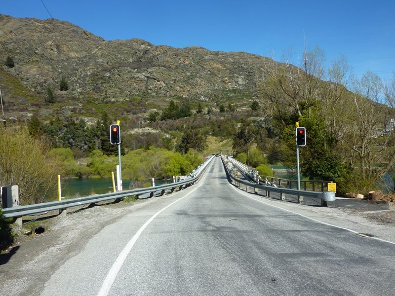
By 1:00 pm I was heading south once again. Across the old Kawerau Bridge which is due to be replaced soon:
The road from Queenstown to Frankton is full of twists and bends, and enough scenery to make you take your eyes off the road. The only down side to this part of the ride is that when fibre optic cable replaced the old copper wires the new cable was layed in a trench right in the middle of of the southbound lane. the road repair that followed was less than perfect, so the whole way to Frankton the lane has either a hollow or a ridge right in the middle. Looking south along Lake Wakatipu to Frankton: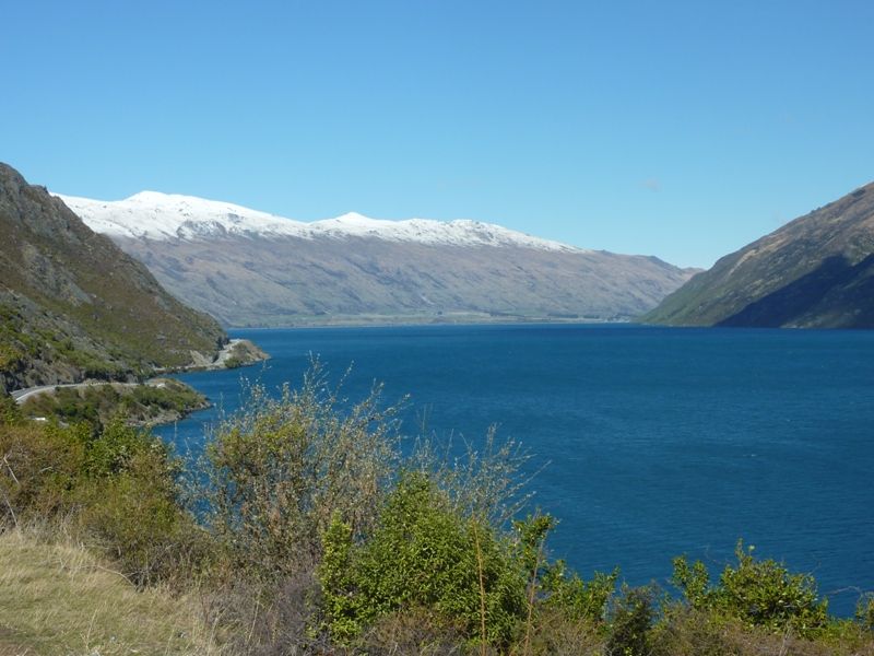
Well today proved to be a beautifull day after a light snowfall last night, and I had an optician's appointment in Queenstown , 85 km away, at mid-day, so I looked at the southern part of the route. 643 km would make a nice afternoon ride and all going well I should arrive home in time for dinner if I'm on the road by 11:00 am.
First stop was Clyde for fuel and check the tyre pressures and a view of the Clyde Power Station:

I'm pretty familiar with this place as that long window just to the right of the pylons is my office. The dam flooded one of New Zealands' most spectacular and inaccessable wild rivers and replaced it with Lake Dunstan that supports fishing, boating, swimming and rowing.
Looking up Lake Dunstan with the Dunstan Range behind:

25 km north is the meeting of the waters. The silty Kawerau River flows in from the west to meet the clear water of the Clutha River. When the lake was raised it flooded part of an historic town at Cromwell, but part of it is still standing as a memorial:

Into the Kawerau Gorge and I stopped for the first Escapade Question at the Goldfieds Mining Center. There is still plenty of gold in them thar hills, just not enough to be economical to recover. Instead tourists are shown how the old gold miners lived and get to experience panning for gold themselves. Looking back along the gold mining reserve a working water sluice can be seen spraying a jet across the river:

Closer to Queenstown is the wine growing area of Gibston Valley. The wines here are very good indeed, but priced accordingly. For the price of one bottle of wine from this region I can get happy with 6 bottles of Australian wine. (One of which I'm happily drinking while I type this):

Most visitors to Queenstown only see the tourist shops in the town center. Locals prefer to shop at their own shopping center with New Zealand prices rather than Tokyo prices, and that is where I saw the optician. The remarkables are looking really good with a fresh touch of snow:

By 1:00 pm I was heading south once again. Across the old Kawerau Bridge which is due to be replaced soon:

The road from Queenstown to Frankton is full of twists and bends, and enough scenery to make you take your eyes off the road. The only down side to this part of the ride is that when fibre optic cable replaced the old copper wires the new cable was layed in a trench right in the middle of of the southbound lane. the road repair that followed was less than perfect, so the whole way to Frankton the lane has either a hollow or a ridge right in the middle. Looking south along Lake Wakatipu to Frankton:

Last edited:


 :
: